
After Harbledown Junction
I had unfinished business with Harbledown Junction and conclude my research in this post. Probably!


Following on from the two part series on Harbledown Junction I still had some extra photos and research to do. In this post I'll look at those, (probably) completing the series. I'd like to acknowledge a friend of mine, MRFS (yes, that's his name) and thank him for lending me some books on the Elham Valley Railway and letting me pick his brains.
To start with, something that should have been obvious that I completely missed while on my walk for part two - the sign saying EVL2031. EVL is an engineers' line reference for Elham Valley Line and 2031 is the asset's number. You'll see markings like this on railway related structures and they detail what it is in relation to a master register. For example, a nearby bridge is labelled ACR1904 - not the year of construction but Ashford Canterbury Ramsgate structure #1904. The next structure along would be ACR1905 (or ACR1903, depending on the direction of travel).
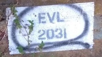
When a station or line is closed the infrastructure still has to be maintained, so even though the bridge has gone at EVL2031 someone is still responsible for the upkeep of the embankment. A lot of lines were closed by Dr Richard Beeching as part of the Beeching Cuts in the 1960s but it should be noted the closure of the Elham Valley Line is not related.
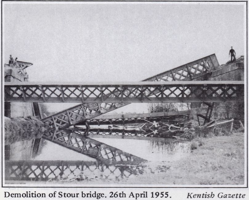
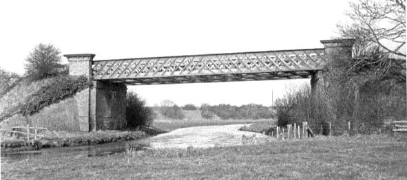
I'd been sent a photograph by Steve, of Love Hambrook Marshes, which showed the "demolition of Stour Bridge" in April 1955 but couldn't immediately place its location (partly due to not standing in the river). M's books had a picture of the bridge when it was operational and, you guessed it, the bridge was at the viaduct I'd been stood on. Originally connected to EVL2031.
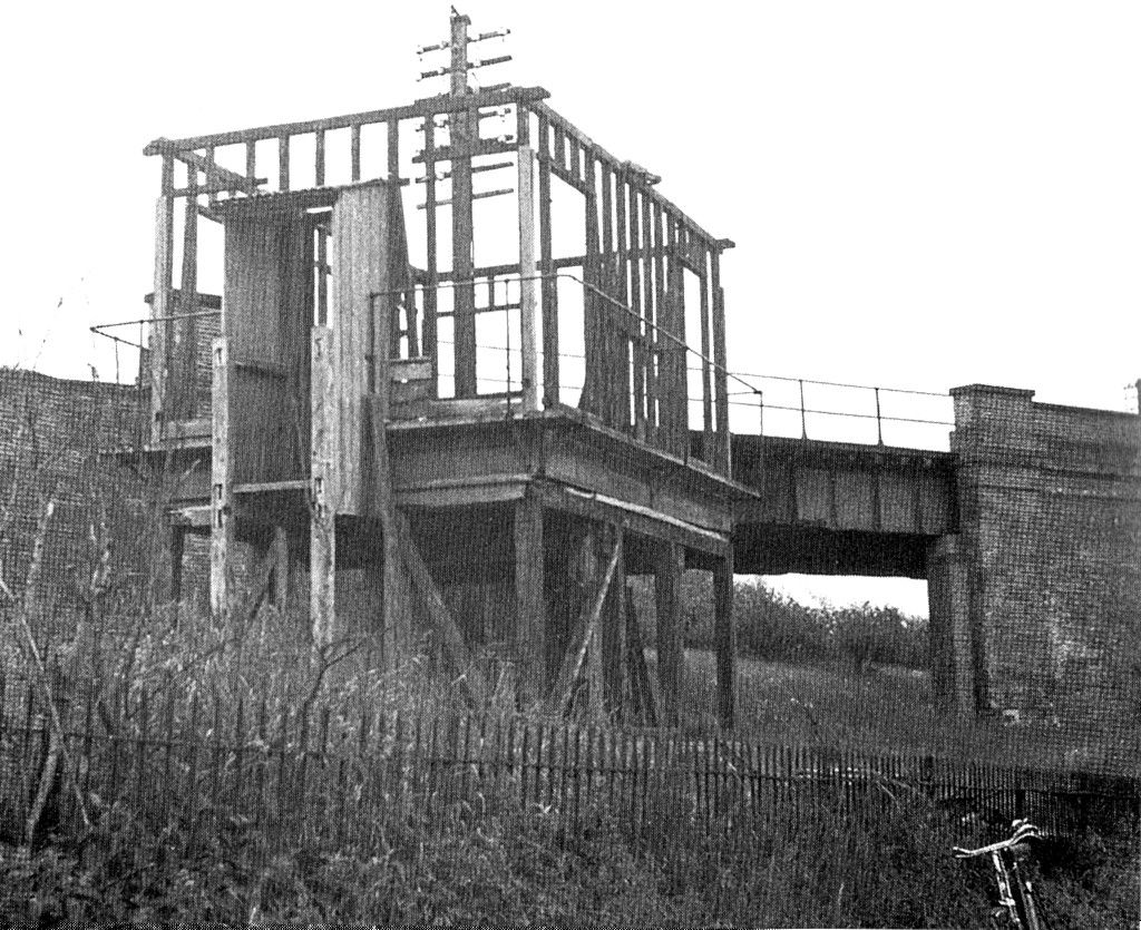
According to Brian Hart's book The Elham Valley Railway, the signal box itself was identical to the one at Cheriton. Signalman would reach the box via Whitehall Road which I walked with my cousin and brother in law in part 2 - there's no access now of course. Looking at the photos in the aforementioned book, we can see the signal box was a wooden slatted building with a timber frame. A photograph partway through demolition, on Thursday 27th April 1950, shows its frame (below) [3].
The house down the line
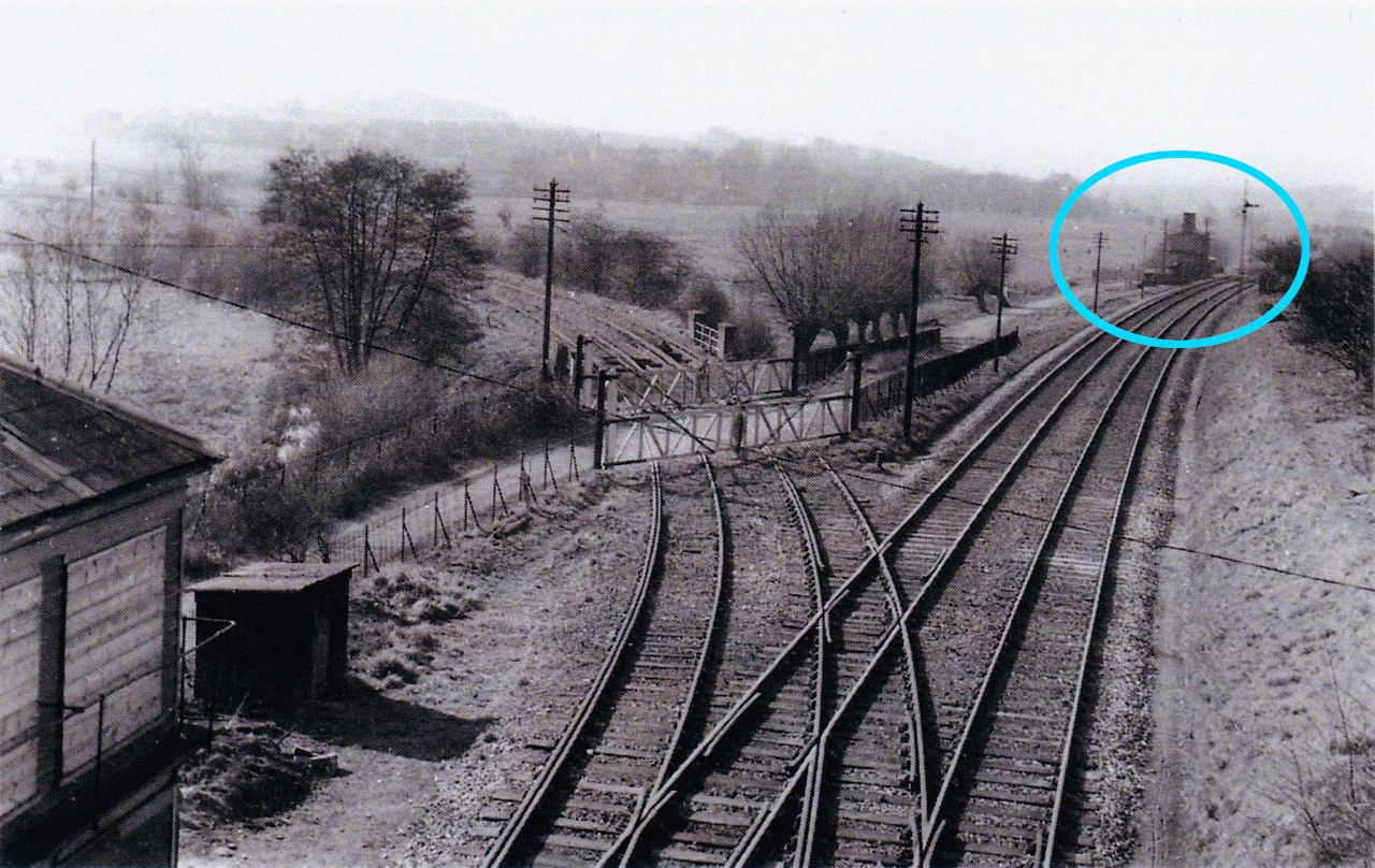
In one of the photos in part 2 it's possible to see what looks like a house in the right background of the picture, annotated above. Trying to find details of that house proved somewhat difficult and I don't recall seeing it on any train journeys. Looking at old maps I could see there was a Whitehall Inn but that was significantly further along and on the other side of the track.
After speaking to M, who mentioned something called optical foreshortening (meaning the object appears closer to the camera than it really is), he located the house. I've annotated the map to show the house (blue arrow) and circled Harbledown Junction:
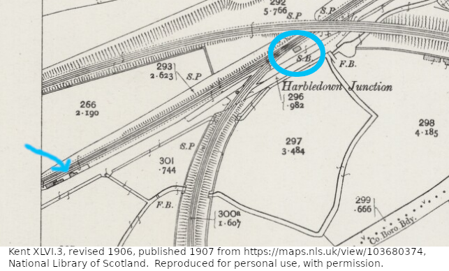
This map is a 1/2500 scale so the house would have been around 234m - 248m away from the signal box as the crow flies. It's likely this was a cottage for the keeper of the nearby crossing (now a "user worked crossing"). As the cottage was owned by the railway, the keeper would have been charged minimal rent. There's nothing there now according to Google maps.
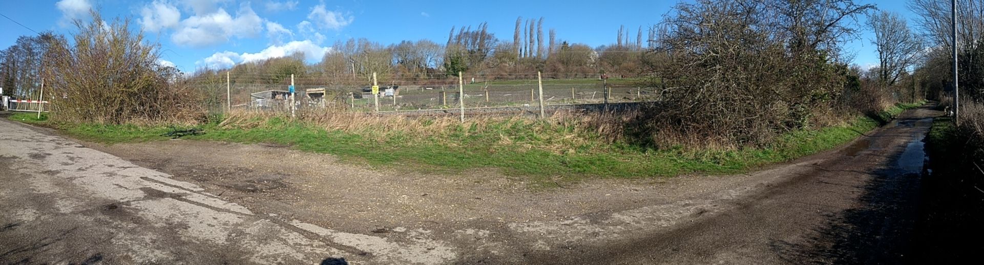
I paid a visit to the site (///land.scarcely.paper) on 10th March 2019 and where the cottage once stood there is just a passing place for cars. A panorama of the site was taken from ///sweep.supporter.saints and you can see my bike to the left. Harbledown junction would have been on the right of the picture, albeit out of shot. To the far left of the image you can see the barrier for a user worked crossing (pump action).
Bricks can be found on the left of the bush nearest the crossing (at ///award.farms.among) although there aren't enough to be a house. Brickwork actually goes back to the modern fencing. Grass has overgrown the area, so this isn't the clearest photo, but I didn't fancy excavating the glass with my bare hands. From the front bricks to the back is approximately 6 and a half feet (just shy of 2 metres). Given the placement I'd suggest this was from the leftmost building shown on the map, rather than the cottage itself:
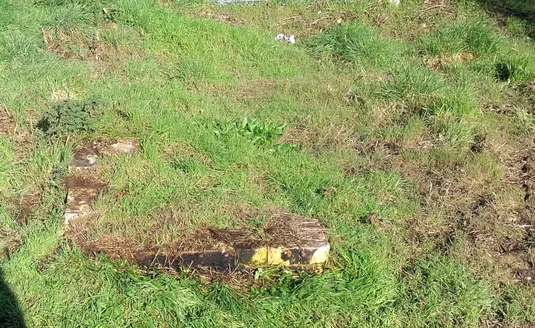
I've not measured or analysed the bricks, so cannot state with absolute certainty these were from the cottage or related buildings, however, it seems likely. Using maps from the National Library of Scotland, I cannot determine how long the cottage was present as the only map for this area, showing the building, is dated 1907 (referenced above).
Military uses of the line
During the second world war the line was taken over for use by the military and housed HMG (His Majesty's Gun) Boche Buster further down the line in the tunnel at Bourne. While this didn't affect Harbledown Junction per se, it is interesting to note.
The future for Harbledown Junction
Given it's been dismantled I agree this is an odd title for this section. That said, there's been talk of setting up a third station in Canterbury again - a topic that surfaces every few years since the 1980s. I noticed this discussion again in the paper last year, complete with an aerial photograph of an area I recognised as being near to the old Harbledown Junction site. Who knows, maybe Canterbury Parkway (other names have been suggested too) will one day grace the site.
Banner image the skeleton of Harbledown Junction signal box [3].
References and acknowledgments
- "Demolition of Stour bridge. 26th April 1955." (c) Kentish Gazette in Hart, B., 2015. The Elham Valley Railway p286. 2nd. Bath: Wild Swan Books Ltd.
- Arthur Wells' photo, 13th March 1955 in Hart, B., 1984. The Elham Valley Railway p31. Bath: Wild Swan Books Ltd.
- Arthur Wells' photo in Hart, B., 2015. The Elham Valley Railway p284. 2nd. Bath: Wild Swan Books Ltd.
- Dennis Callum's photo, 28th February 1953 in Hart, B., 2015. The Elham Valley Railway p278. 2nd. Bath: Wild Swan Books Ltd.
Thanks go to What3Words for creating an easy to use co-ordinate system.